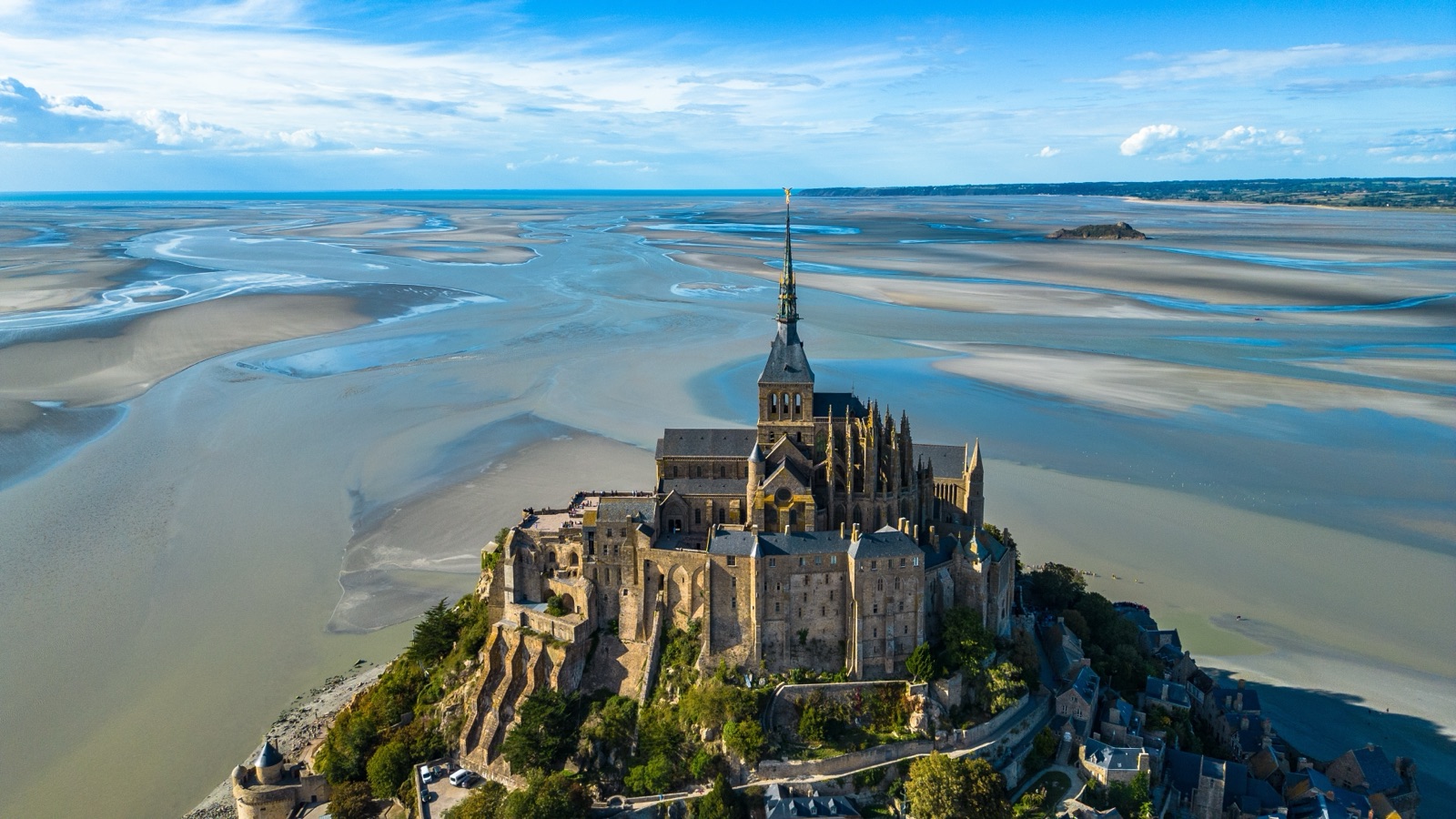
Things to Do Near Mont-Saint-Michel: Saint-Malo, Cancale, Avranches and the Bay
The bay around Mont-Saint-Michel is worth more than a glance from the abbey terrace. On the Normandy shore, Avranches has the abbey’s own manuscripts in the Scriptorial and the relic of Saint Aubert, the bishop who founded the Mont; Genêts is the starting point for guided crossings of the sands; and Granville has a walled old town on a rocky point. On the Brittany shore, Mont-Dol gives a view over the whole bay, Cancale is the oyster port, and Saint-Malo is a walled corsair city rebuilt after 1944. Further out, Dinan, Combourg and Cap Fréhel make good day trips, and Bayeux and the D-Day beaches are within reach by shuttle.
This guide goes round the bay shore by shore, says what each place is best for, and suggests how to combine them with a visit to the Mont, with or without a car.
The places at a glance
| Place | Shore | Best for | Getting there from the Mont |
|---|---|---|---|
| Beauvoir and Moidrey | Normandy | Windmills, the polders, the walk in | The greenway; Beauvoir is 4.5 km away |
| Pontorson | Normandy | Market day, the railway | About 10 km; line 2 bus |
| Huisnes-sur-Mer | Normandy | A war memorial and a view | A short drive |
| Genêts and the Bec d’Andaine | Normandy | Guided bay crossings, Tombelaine | By car round the bay |
| Vains and the Grouin du Sud | Normandy | The tidal bore, the Eco-Museum | By car round the bay |
| Avranches | Normandy | The Scriptorial, Saint Aubert’s relic | By car; a 12 km cycle link from Pontaubault |
| Granville | Normandy | The Haute-Ville, Dior, Chausey | By car |
| Villedieu-les-Poêles | Normandy | Copper and bells | On the Paris train line |
| Mont-Dol and Dol-de-Bretagne | Brittany | A view over the bay, the cathedral | By car or bike |
| Cancale and the Pointe du Grouin | Brittany | Oysters, coastal paths | By car or the coastal cycle route |
| Saint-Malo | Brittany | The walled city and its ramparts | Keolis Armor coach, 1h |
| Combourg | Brittany | Chateaubriand’s castle | By car |
| Dinan and Cap Fréhel | Brittany | Medieval ramparts, cliffs | By car |
Distances on the coastal cycle route help with planning: the Vélomaritime stage from Le Vivier-sur-Mer to Mont-Saint-Michel is 29 km, from Cancale to Le Vivier-sur-Mer 21 km, and from Saint-Malo to Cancale 18 km. Our article on where Mont-Saint-Michel is explains the geography of the two shores.
Right next to the Mont: Beauvoir, Moidrey and Pontorson
You pass through this stretch on the way in, and it deserves more than a windscreen view.
- Beauvoir. The last village before the Mont, where the Tourist Information Centre has its address. The nearest supermarket and bakery are in Beauvoir, 4.5 km from the Mont. From Beauvoir the walking and cycling route reaches the dam after another three kilometres.
- The mills. North of Pontorson the road crosses vegetable fields with old windmills on the ridges. At the Moidrey windmill a miller still makes flour using only the wind, and the view runs over the polders to the Mont.
- Moidrey cove. The Moidrey cove, a natural area along the Couesnon estuary 7 km from the Mont, has an interpretation trail with the Mont as a backdrop.
- Pontorson. Pontorson is about 10 km from the Mont, and its station is the nearest to it. Pontorson holds a market every Wednesday, and its church of Notre-Dame was built on the orders of William the Conqueror by the same architects as the Romanesque abbey. The Couesnon runs through the town, and the border with Brittany today lies four kilometres west of the river.
Huisnes-sur-Mer: the German mausoleum
On a hill on the edge of the bay, a few kilometres from the Mont, stands a sober reminder of the Second World War. The German mausoleum on Mont d’Huisnes is the only German military mausoleum in France. It was inaugurated on 14 September 1963, stands on a 30-metre hill and is circular, with two galleries containing 68 crypts. A total of 11,956 people are buried there, soldiers but also women and children, brought from the western quarter of France and the Channel Islands. From the top of its stairs you can see the Mont in the distance over the salt meadows.
Genêts, the Bec d’Andaine and the bay crossings
Genêts was once one of the largest trading ports, now silted up. Today it is known as the starting point for guided crossings of the bay, from the Bec d’Andaine, a sandy point 1.5 km from the village. Pilgrims crossed from here to the Mont in the Middle Ages, and guided crossings have become popular again.
The walk to the Mont or to Tombelaine is done only with a guide. The islet of Tombelaine, 3 km from the Mont, was an English stronghold in the Hundred Years’ War and still holds ruins from that time; it is a bird reserve. Parking at the Bec d’Andaine is charged from 1 April to 31 October at €6 a day, with the first 2 hours free. Our guide to tides and bay walks compares the guided walks, their prices and what to wear.
Vains-Saint-Léonard, the Grouin du Sud and Saint-Jean-le-Thomas
North of the Mont, the Normandy shore has the best views back across the water:
- The Grouin du Sud. The tip of the Grouin du Sud near Vains is a place to watch the Mont, ideally on a rising tide with a high coefficient for the tidal bore.
- The Bay Eco-Museum. Near Vains-Saint-Léonard you can visit the Bay Eco-Museum, on the bay’s wildlife and the people who have worked it.
- Saint-Jean-le-Thomas. The cliffs of Saint-Jean-le-Thomas give one of the most beautiful viewpoints over the bay.
This coast is also where people gather shellfish at low tide, but the rules are strict. Gathering shellfish is now allowed only north of Saint-Jean-le-Thomas, as far as Granville, with size and quantity limits, and the tourist office advises setting out about two hours before low tide, to leave time to come back. Never follow the tide out far onto the sands.
Avranches: the manuscripts and Saint Aubert
Avranches is where the story of the Mont begins. According to legend, the history of Mont-Saint-Michel begins in 708, when the archangel Michael appeared to Bishop Aubert of Avranches in a dream and asked for a sanctuary on the rock. The town, on a height above the countryside, has a panoramic view over the bay.
What to see:
- The Scriptorial. The Scriptorial in Avranches shows the manuscripts of Mont-Saint-Michel; adult entry is from €9. Two hundred of the abbey’s medieval manuscripts are now kept in Avranches, and the manuscripts on show in the Scriptorial’s treasure room change every three months.
- Saint Aubert’s relic. The basilica of Saint-Gervais in Avranches holds the relic of Saint Aubert, kept in a crystal, vermeil and lapis lazuli shrine dating from 1895.
- Place Patton. On the Place Patton in Avranches stands a Sherman tank. General Patton’s soldiers arrived on 31 July 1944, the Avranches Breakthrough.
- The keep and the gardens. You can climb to the top of the keep in Avranches to look down on the old town, and the tourist office lists the view from the public garden among the bay’s viewpoints.
There is a practical bonus: from 1 October 2026 to 31 March 2027 a Scriptorial d’Avranches ticket reduces the abbey ticket to €11.50. Cyclists can use a signposted 12 km link from Pontaubault bridge to Avranches station across the salt meadows.
Granville: the Haute-Ville and Chausey
At the northern end of the bay, Granville is a port and seaside town with an old walled quarter. The ramparts of Granville’s Haute-Ville, on the Pointe du Roc, are not to be missed. The Christian Dior garden and museum in Granville is the designer’s childhood home, and from Granville you can sail to the Chausey archipelago; from Granville, Manche Iles Express also sails to the Channel Islands.
In the countryside of Granville Terre et Mer, a stretch known as the most beautiful kilometre in France has a view of the Mont.
Villedieu-les-Poêles: copper and bells
Inland, on the railway from Paris, Villedieu-les-Poêles was founded in the 12th century by the Knights of Malta and became famous for copperwork and pans, hence its name. The Cornille-Havard bell foundry in Villedieu can be visited with a guide. If you are coming by train, Nomad trains from Paris-Montparnasse reach Villedieu-les-Poêles in 2h50, and a connecting bus runs to the Mont’s visitor car parks in 45 minutes, so the town is an easy stop on the way.
Mont-Dol and Dol-de-Bretagne
Across the Couesnon in Brittany, the flat marshes are broken by one granite hill. Mont-Dol rises to 65 metres, and from the top the view extends over the whole bay. The 10-metre Notre-Dame tower on Mont-Dol, inaugurated in 1857, has a spiral staircase to a viewing platform. The hill has a long human history: hunter-gatherers settled at its foot 110,000 years ago.
Dol-de-Bretagne, a short way inland, is a small cathedral town:
- The cathedral, the town’s great sight, with a tower left unfinished.
- The Cathédraloscope, an exhibition centre on cathedrals and their builders.
- The Grande Rue des Stuarts, with the oldest house in Brittany, the Maison des Petits Palets.
- The Champ Dolent menhir, one of the highest in Brittany.
From Le Vivier-sur-Mer you can go inland to Dol-de-Bretagne, about 10 km away, stopping on Mont-Dol on the way.
The Breton shore: Cherrueix, Le Vivier and the mussels
Between Mont-Dol and Cancale the coast is low and wide. The cycle route passes the bay-side village of Cherrueix with its windmills and St Anne’s Chapel, and between Cancale and Le Vivier-sur-Mer it passes one of the bay’s main mussel-farming areas, known for AOP bouchot mussels. The AOP mussels are seasonal: the season generally opens in July and runs to February, depending on the harvest.
At Le Vivier-sur-Mer, the Maison de la Baie leads guided nature walks on the Brittany side of the bay, in groups of about 25. Its nearest station is Dol-de-Bretagne. Our article on the bay’s wildlife covers the seals and birds you might see.
Cancale and the Pointe du Grouin
Cancale is a port renowned for high-quality oysters. At La Houle, the port of Cancale, oyster farmers work the beds that appear at low tide. Cancale has 13 km of coastal paths, and the Pointe du Grouin, north of Cancale, divides the shore facing the bay from the Emerald Coast. From the Mont’s west side you can see this coast in the evening, ending at the cliffs and lighthouse of the Pointe du Grouin.
Saint-Malo: the corsair city
Saint-Malo is the big town of the Breton side and the ferry port for many British visitors. Since the 1967 merger of three communes, Greater Saint-Malo has nearly 50,000 inhabitants. In August 1944, 80% of Saint-Malo’s buildings were destroyed; the walled city was rebuilt in its historic look.
The essential walk is the ramparts. Saint-Malo’s ramparts form a loop of about two kilometres, and the walls today have eight gates, three posterns and three bastions. Chateaubriand’s tomb, facing the open sea, can be visited at low tide.
Getting between the two is easy without a car on the days the coach runs. A day return from Saint-Malo is possible with Keolis Armor coaches; the days vary by period and the journey takes 1h. The direct coach has fares from €21 and leaves from the Esplanade Saint-Vincent stop in front of the tourist office. Our guide to getting to Mont-Saint-Michel has the details.
Combourg, Dinan and Cap Fréhel
Further into Brittany, three places make a full day out:
- Combourg. A visit to the Château de Combourg begins with its 25-hectare park. Chateaubriand was 8 years old when he first moved to the castle, and it is still lived in by descendants of the Chateaubriand family.
- Dinan. Dinan has three kilometres of ramparts, 14 towers and gates and 70 historic monuments, above the valley of the Rance.
- Cap Fréhel and Fort La Latte. Cap Fréhel has 400 hectares of moorland, and nearby Fort La Latte is built entirely of pink sandstone on a rocky cape.
Bayeux and the D-Day beaches
East of the bay, Bayeux is a natural partner for the Mont. Scenes 16 and 17 of the eleventh-century Bayeux Tapestry show knights facing quicksand in front of Mont-Saint-Michel, so the two make a good pair. Shuttles from Bayeux with abbey entry included take the planning out of the day, and the VéloWestNormandy cycle route links the D-Day landing beaches to Mont-Saint-Michel for anyone with more time.
Combining the Mont with nearby places
Some day plans that work, with the Mont at the centre:
- The Normandy loop. The abbey in the morning, then Avranches for the Scriptorial and the view, and back via Genêts or the Grouin du Sud for the evening tide.
- The Breton loop. The Mont early, then Mont-Dol for the panorama, the mussel coast and Cancale for oysters, ending in Saint-Malo.
- A guided crossing day. A walk from Genêts across the sands to the Mont or Tombelaine, with the abbey kept for another day.
- The train traveller’s day. Villedieu-les-Poêles on the way in, the Mont, then Pontorson for the train onwards.
The bay is big enough that two of these in one day is ambitious. If you have a car, base yourself somewhere central; our guide to where to stay compares Pontorson, Avranches and Saint-Malo as bases.
Getting around without a car
It is possible to see some of the bay by public transport and bike:
- Coaches. Keolis Armor runs two regular direct coach lines to Mont-Saint-Michel, from Rennes and from Saint-Malo.
- Local bus. Line 2 from Pontorson to Mont-Saint-Michel runs every day, serves 4 stops and takes about 27 minutes.
- Trains. Pontorson / Mont-Saint-Michel station is on the Granville to Saint-Malo line, with 2 trains a day on average serving the Mont.
- Bikes. France Vélo Tourisme’s coastal ride from Mont-Saint-Michel to Saint-Malo is 68 km, along the Breton shore, and the GR 34 footpath follows the whole bay from Cancale to Granville.
Frequently asked questions
What is there to do near Mont-Saint-Michel? Avranches for the Scriptorial, Genêts for guided bay crossings, Granville’s Haute-Ville, Mont-Dol for the view, Cancale for oysters and Saint-Malo for its ramparts are the main options.
Can you visit Mont-Saint-Michel and Saint-Malo in one day? Yes. The Keolis Armor coach takes 1h on the days it runs, so the abbey in the morning and Saint-Malo in the afternoon is realistic.
Where are the abbey’s manuscripts? In Avranches, at the Scriptorial, where the display changes every three months.
Where is the best view of the whole bay? From the top of Mont-Dol, or from the cliffs of Saint-Jean-le-Thomas on the Normandy side.
Planning the Mont itself as part of a wider trip? Compare the tours and tickets, including shuttles from Bayeux with abbey entry included.